Gozo’s Secret Salt Pans — Hiking from Xatt l-Aħmar to Ras il-Hobz
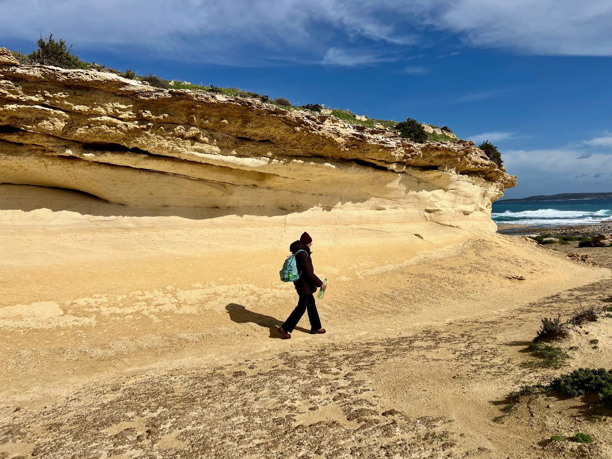
Walking alongside eroded limestone formations
If you think Gozo is just for summer swimming, you are missing out on fantastic hikes that you can just do in winter or the shoulder season. We booked this weekend trip ages ago, not knowing that Storm Harry would batter the islands just days before.
To be honest, the start was rough. We took the Fast Ferry from Valletta on Friday evening. The moment we passed by St. Julians, the waves were getting massive and even smashed against the front window of the ferry.
The crew was busy handing out bags as half of the few passengers on board got sick. That’s the price you pay for a winter adventure.
In short: Xatt l-Aħmar
The Route: Xatt l-Aħmar to Ras il-Ħobz (coastal trail)
Difficulty: Moderate, but close to the cliffs and slippery when wet
Highlights: Salt Pans and Qala ta' Michal rock formations
Location: Near Mgarr port
On Sunday morning the storm had passed, leaving behind incredibly clear skies. We decided to do a trail that most tourists completely ignore: The coastal walk from Xatt l-Ahmar to Ras il-Hobz.
Getting to Xatt l-Ahmar
We ordered a Bolt from Nadur (where we were staying) to the Xatt l-Ahmar Parking. The last bit is a steep road going from Ghajnsielem and the Saint Eliju area down to the sea.
If you are coming to Gozo for a day trip, this hike is pretty time-efficient since it’s not far away from the port.
Green hills & angry waves
Green Gozo in winter
As soon as we got out of the car, we were hit by the colours. Because of the winter rains, Gozo is extremely green in January. Very different to the dry fields you get to see in July.
From the parking lot we walked west towards the famous "Fougasse".
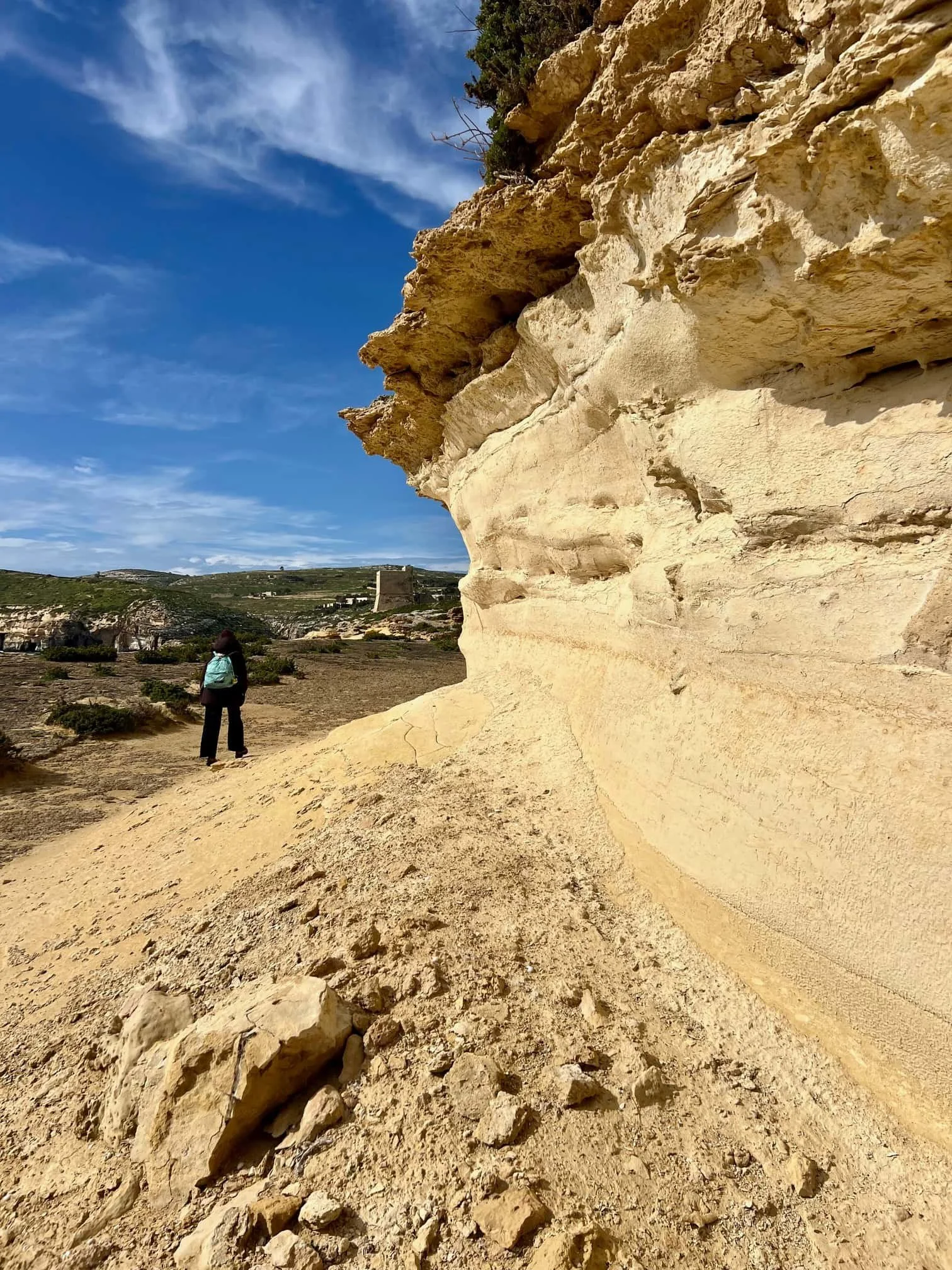
Hiking route from Xatt l-Ahmar Parking to Ras il-Hobz
Fougasse
Only a minute away from the parking you can see a large, circular pit carved into the rock at a 45-degree angle. It’s a Fougasse, an 18th-century weapon.
The Knights of St John carved these into the limestone to defend the coast. They would fill the hole with gunpowder, top it with hundreds of heavy stones and light the fuse. The result was a massive "stone shotgun" aimed at enemy ships trying to land at Fort Chambray nearby.
This specific Fougasse was actually lost to nature and was only re-discovered and dug out in 2005.
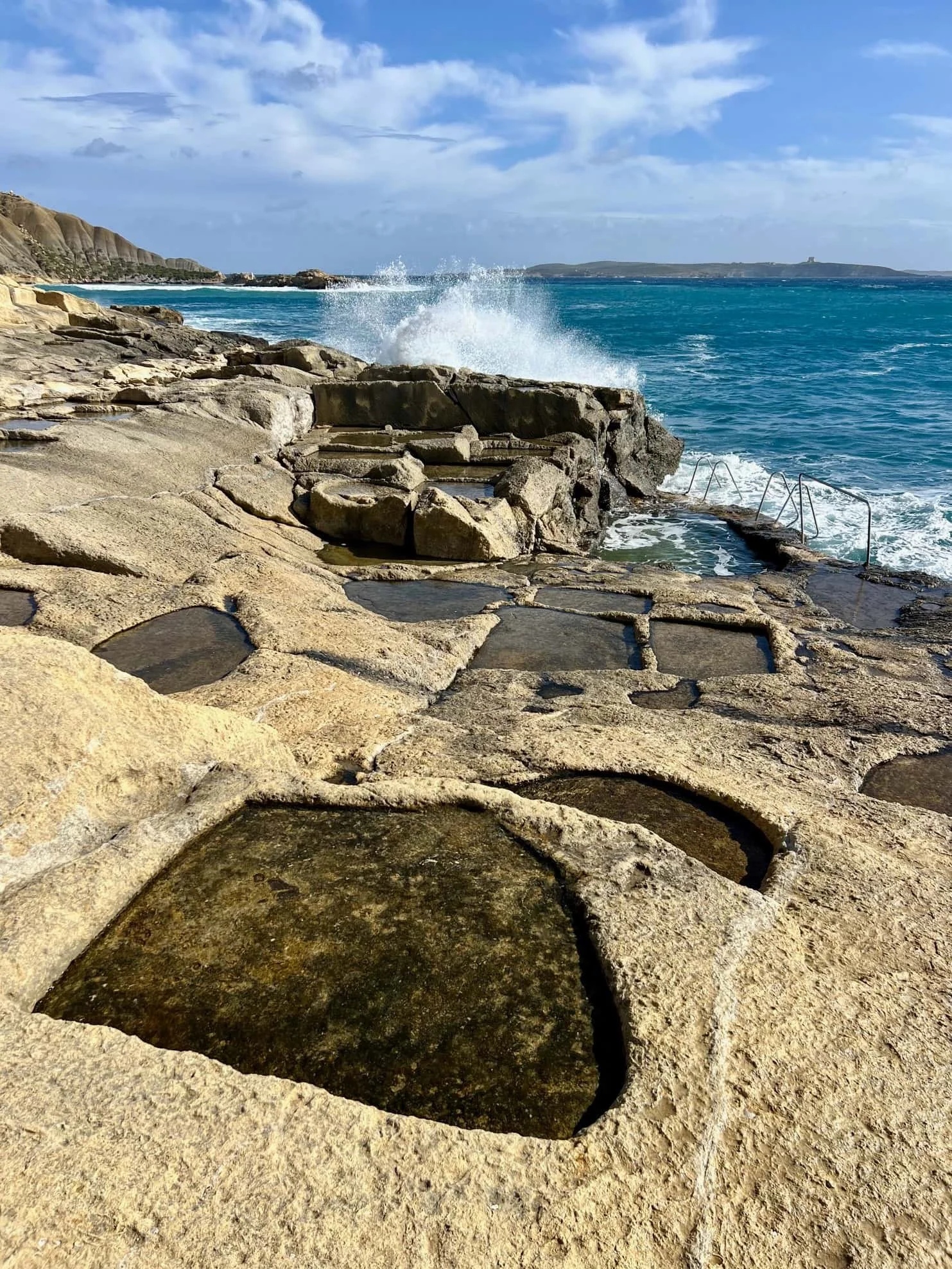
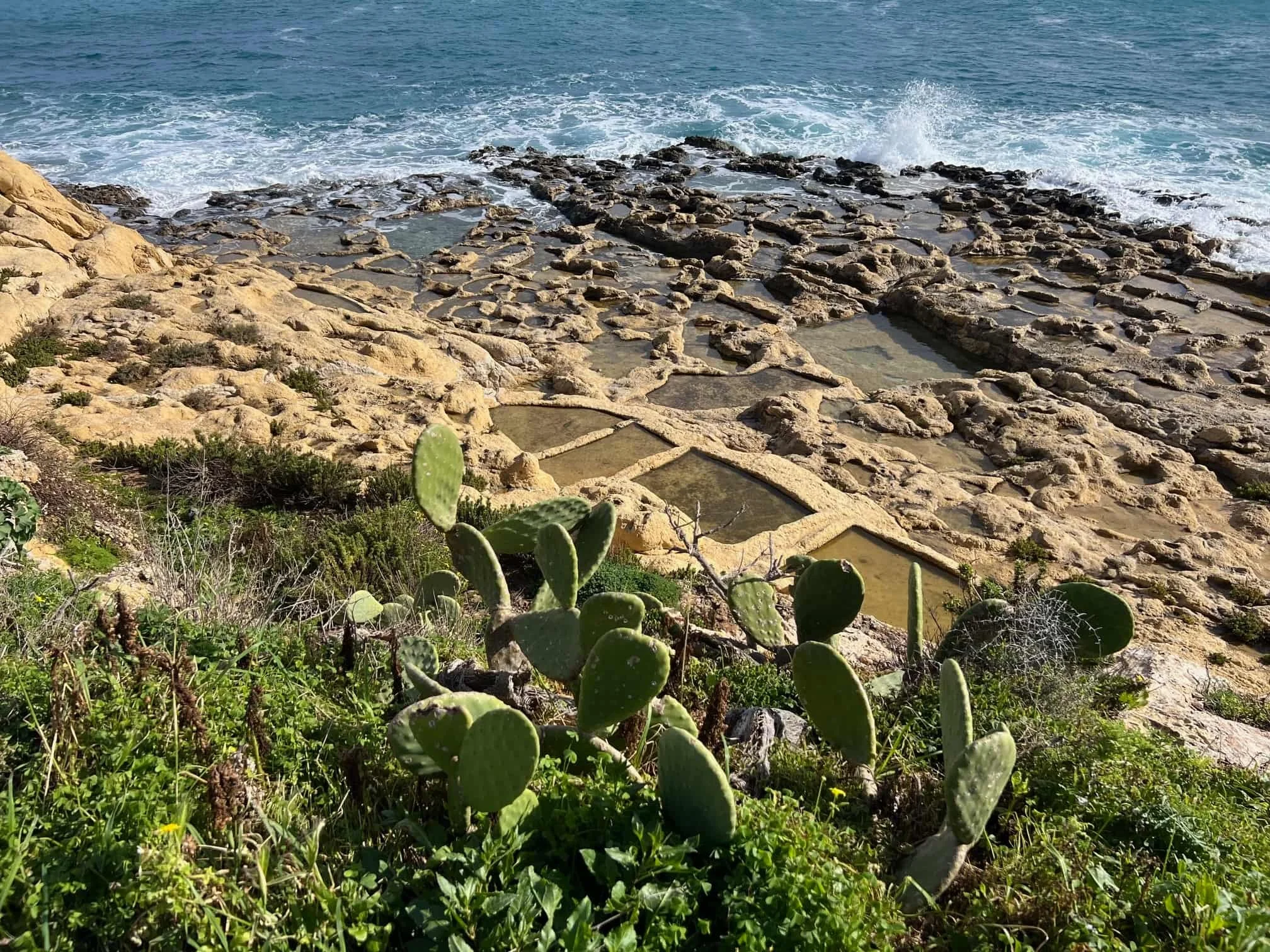
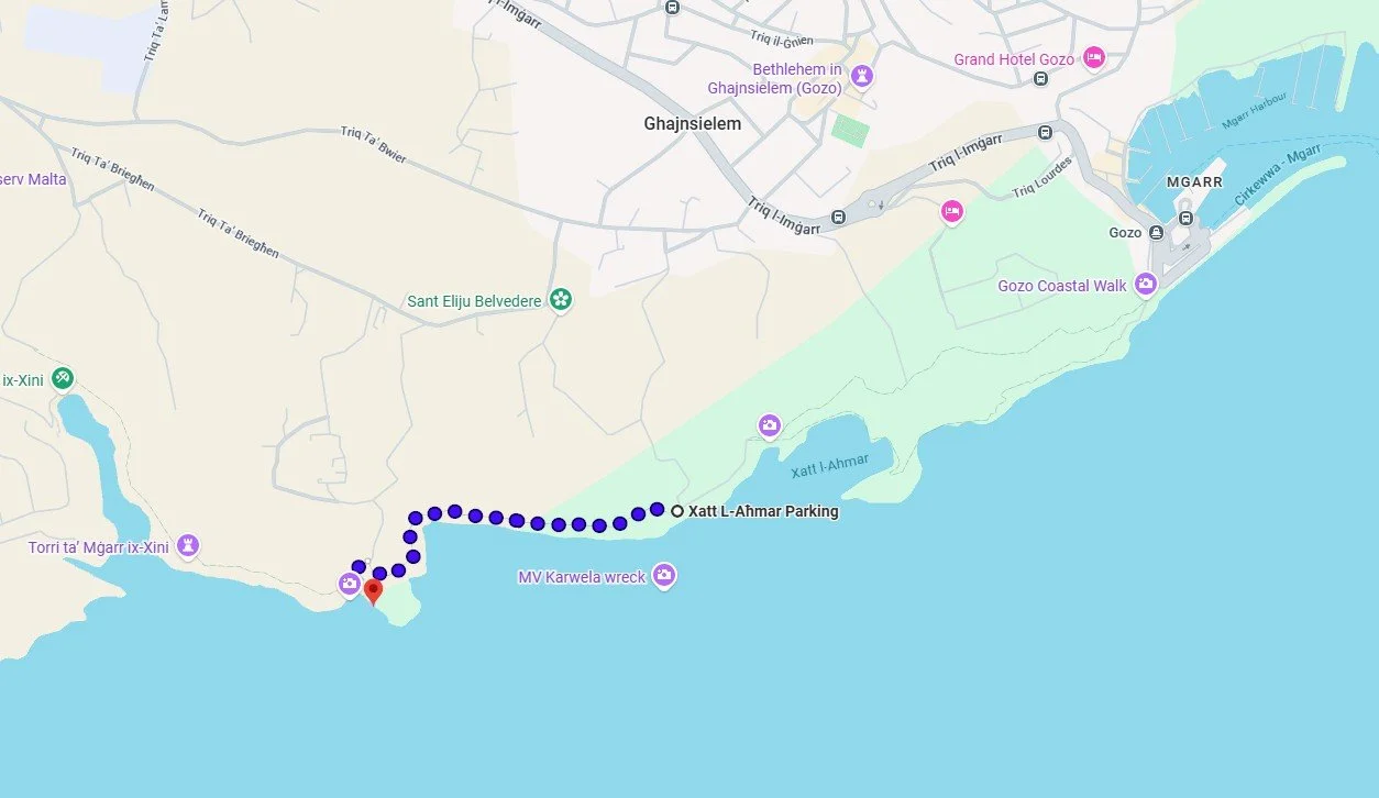
Salt Pans
Rectangular shaped salt pans carved into the limestone
Everyone knows the salt pans in Marsalforn. They are nice, but there are always tourists around. The ones here at Xatt l-Ahmar are off most people’s path. For these photos we had to be super careful not to get soaked or swept off by the powerful waves pushing in.
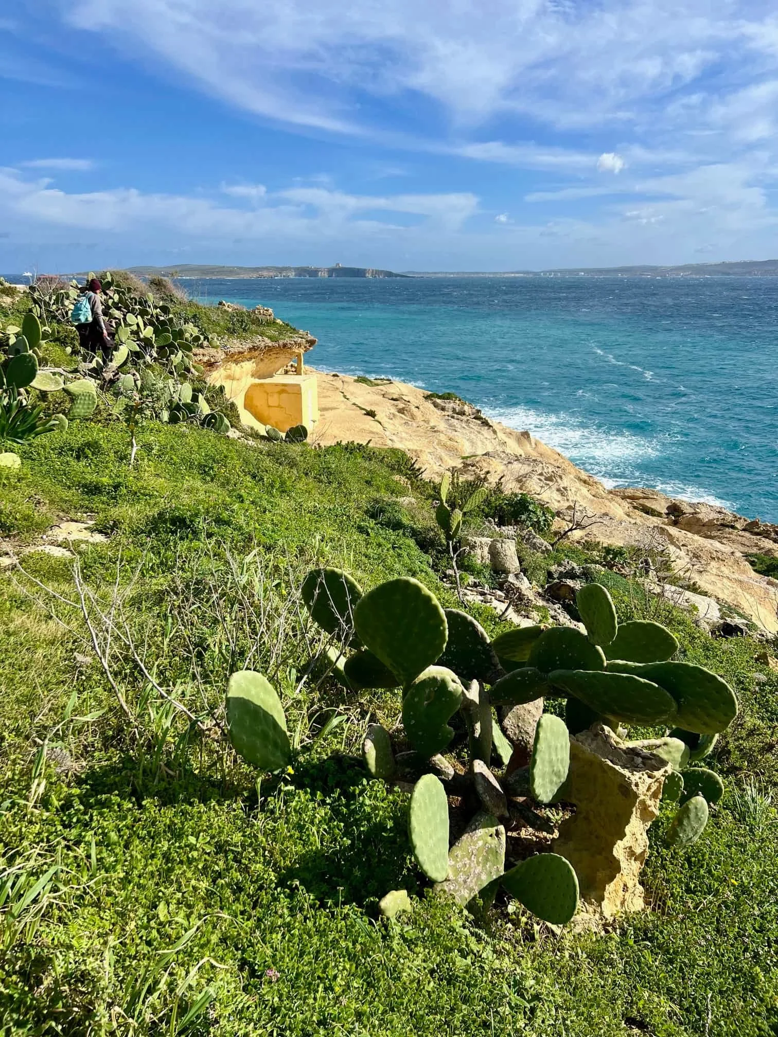
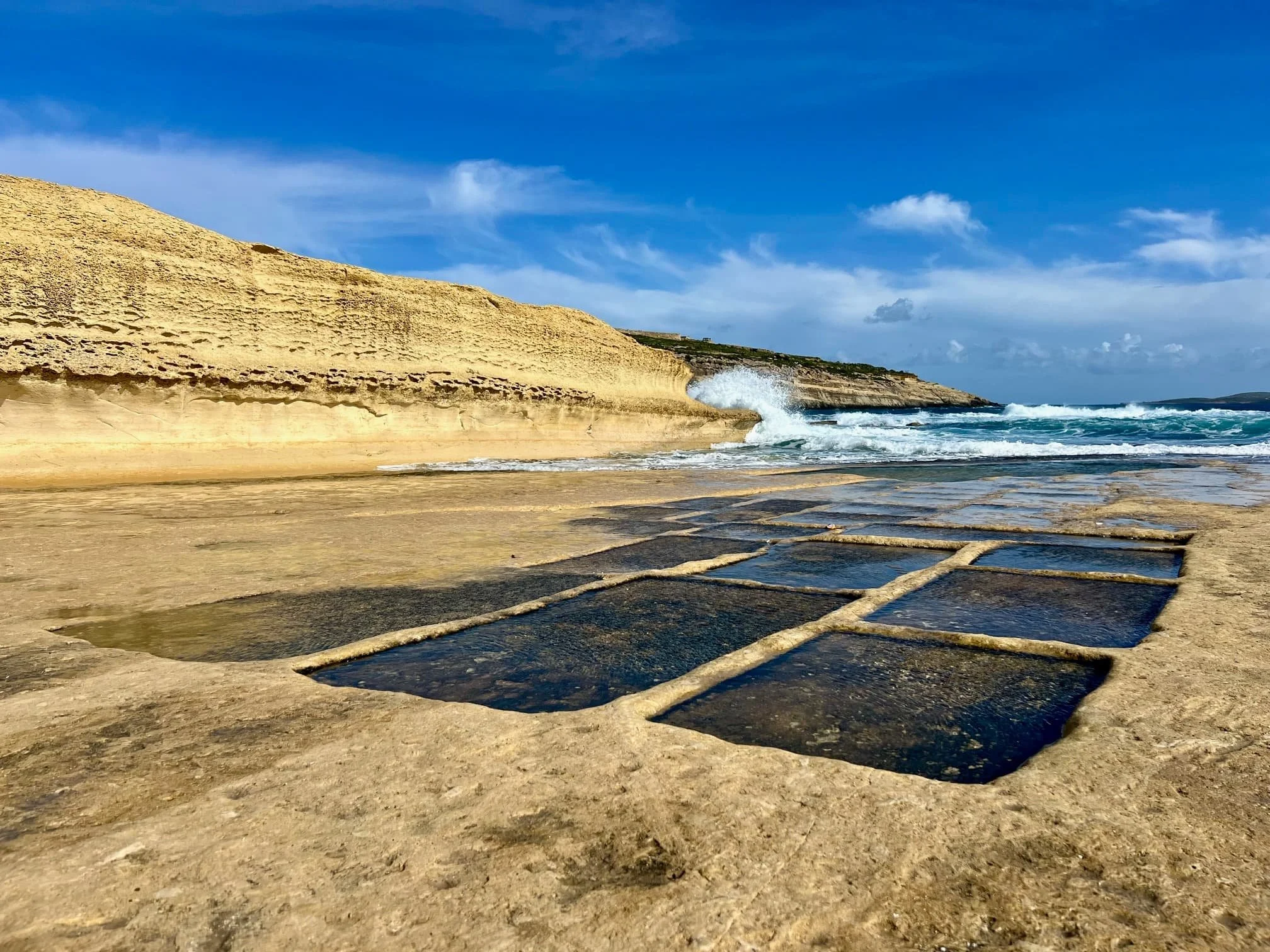
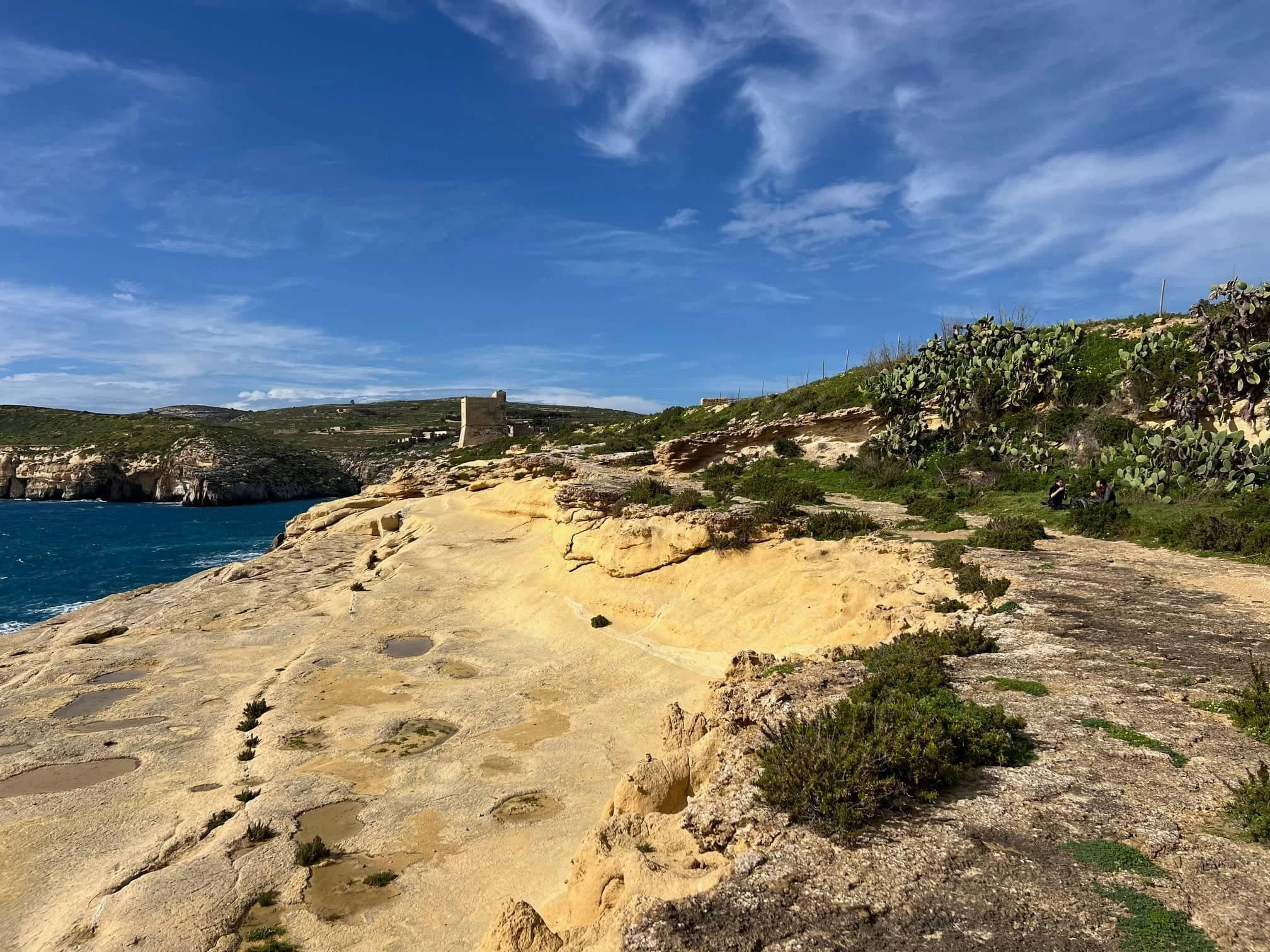
Qala ta' Michal
Eroded limestone near Qala ta' Michal
Cliffs of Qala ta' Michal
Further along, we reached Qala ta' Michal. For me, this was the visual highlight. The colours of the stone here are insane — layers of yellow, orange and white shaped by wind, water and salt. In summer the little hidden beach is a great spot for snorkeling.
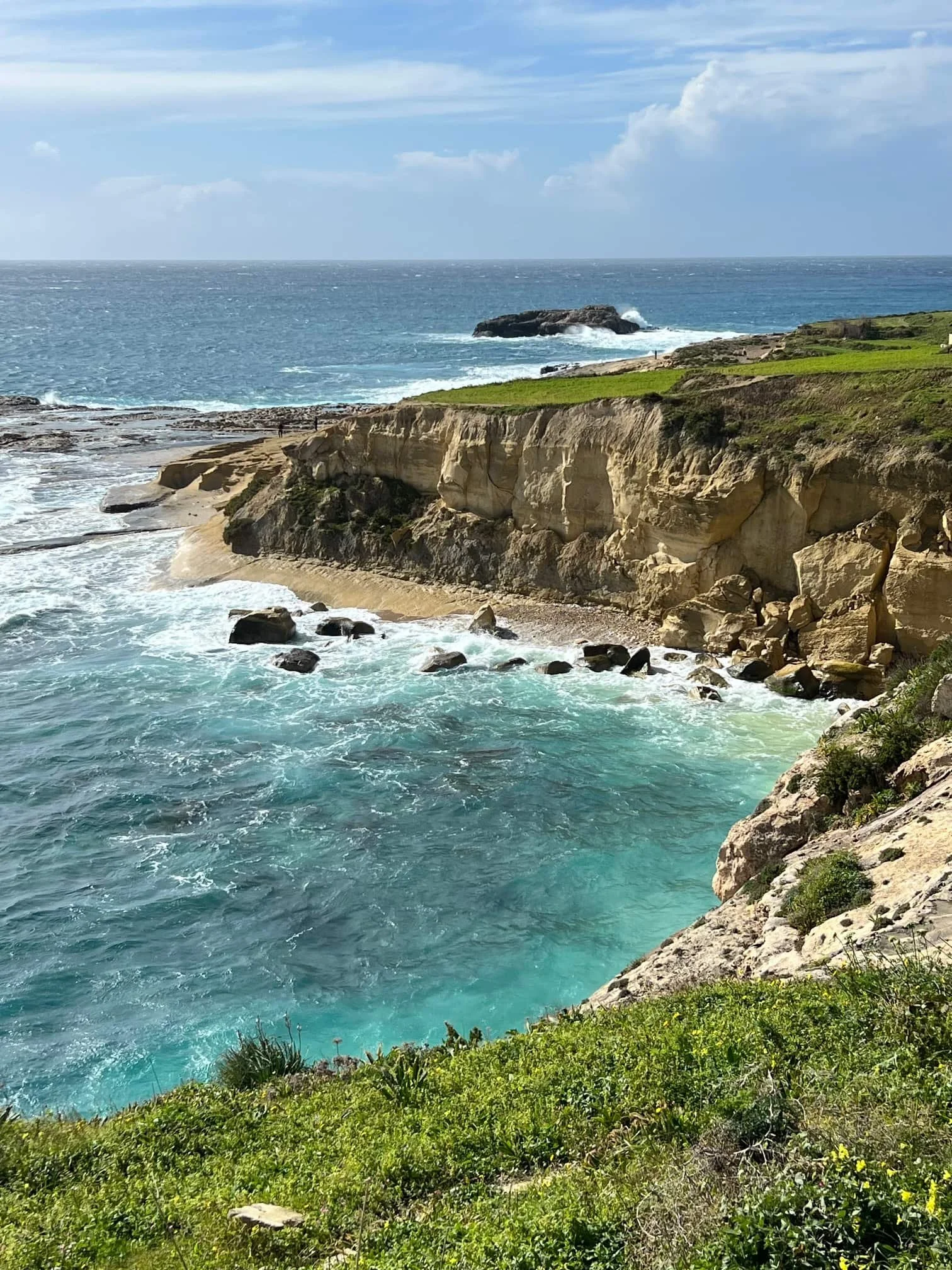
The "Middle Finger"
Behind Qala ta’ Michal there is a famous underwater rock called the "Middle Finger", officially known as Ras il-Hobz. It is a massive vertical rock pinnacle that rises from the deep sea. For divers this is one of the most famous spots in Gozo. Unfortunately diving wasn’t part of our programme in January.
Instead we took a last break to enjoy the perfect view of the watchtower Torri ta’ Mgarr ix-Xini before returning to the parking lot.
View towards Torri ta’ Mġarr ix-Xini
Going home
We assumed we could just call a Bolt from the Xatt l-Aħmar parking lot. Wrong :( The road is steep and the area kind of remote and drivers seemed to decline the ride.
Malta isn’t the typical hitchhiker island. But we gave it a try. The first (Maltese) couple we met at the parking gave us a lift to the port. Lucky us, we had done this hike with our entire weekend baggage as we planned to go straight to the port after the hike. They saved us a tough walk back up the hill. In winter you can’t walk along the shore back to Mgarr port.
On Sunday afternoon the Fast Ferry was cancelled again due to the waves in the channel and we had to take the larger ferry to Cirkewwa. Because of the wind direction we took a completely different route around the back of Comino.
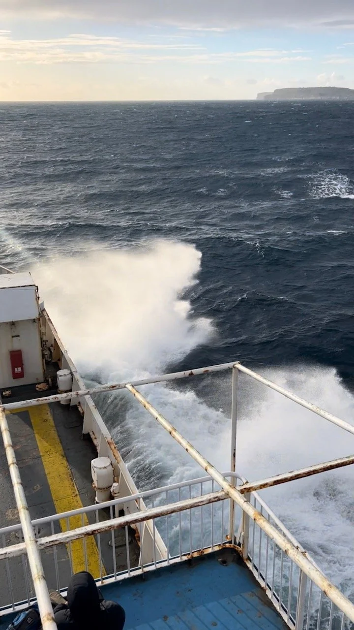
Screenshot from a video we took from the upper deck
It took three times longer than usual, but seeing Comino's massive cliffs from that angle was amazing.
Note for everyone who works in Malta and comes for the weekend: I didn't bring my work laptop or charger. If the ferries had stopped completely, Monday morning would have been a disaster. Always pack your laptop, just in case!
Want to read about other Gozo trips we did? Read our blogs about our Road trip from Ta’ Pinu to the Sand Waves and our Hike from Mgarr to Hondoq Bay.
Follow us on Instagram!
Author: Bjorn


We were looking for a hike off the tourist crowds in August and discovered this short coastal walk from Mgarr Harbour to Hondoq Bay.